|
| |||||||||||||||||||||||||||||
|
Feb 13 – Mar 23, 2006 El Calafate - El Chaltén (Argentina) – Candelaria Mancilla – Villa O’Higgins - Tortel – Coyhaique – Chaitén – Quellón – Castro – Ancud – Puerto Montt (Chile) | |||||||||||||||||||||||||||||
|
| |||||||||||||||||||||||||||||
|
Argentina’s Parque Nacional de los Glaciares composes of two distinct parts. Leaving the magnificent Perito Moreno Glaciar near El Cal fate, it was some 220km by road to the famous Fitzroy and Cerro Torre mountain peaks on the north end of the park. Here follows an outline of a not-so-typical day in the cycling life of Kurt and Darina:
| |||||||||||||||||||||||||||||
|
By the time we reached El Chaltén, had there been a International airport Kurt would have had us on the first flight out to Fiji! Well, there was no airport, so we did what all the others do… and hiked around the park. With exceptional weather we saw spectacular Fitzroy and Cerro Torre in all their glory. And the view from our tent made it all worth the pain! |
| ||||||||||||||||||||||||||||
 |
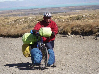 | ||||||||||||||||||||||||||||
| Kurt at the start of the day... |
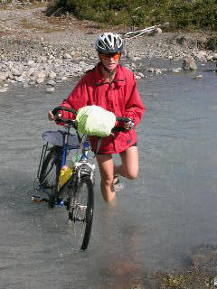
...and towards the end! | ||||||||||||||||||||||||||||
|
|
|||||||||||||||||||||||||||||
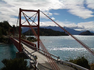
Where's the bridge! |
From here we crossed Lago del Desierto and then followed a horse track up to the Chilean border and down the other side to Lago O’ Higgins. This crossing is only for hikers and cyclists as it 's really a dirt trail through a forest, opening up to a tractor path on the Chilean side. In places the trail is simply too narrow for a packed bike and the odd bridge is also missing. So by loading our luggage on a horse, we were able to make the crossing in only four hours. | ||||||||||||||||||||||||||||
 |
 | ||||||||||||||||||||||||||||
| Lady's slipper |
Woodpeckers | ||||||||||||||||||||||||||||
|
Another boat later we arrived in Villa O’Higgins to commence our ascent on the Carretera Austral. Bernardo O’Higgins is to the Chileans what Daniel O’Connell is to the Irish and William Tell is to the Swiss. Of Irish descent,O’ Higgins was responsible for liberating Chile from the Spanish in 1817, and is a national hero with all main drags bearing his name. |
| ||||||||||||||||||||||||||||
|
The Carretera Austral is a road that was designed to open up land and settle this remote area of southern Chile. Work started in Puerto Montt in the 1970s and the track reached Villa O’Higgins, some 1100km later, about 6 years ago. | |||||||||||||||||||||||||||||
Views that are hard to beat |
The route leads through gorgeous valleys with fast flowing rivers and turquoise lakes. Quite often a random stop would offer panoramic vistas of up to 14 glaciers. Waterfalls are a dime a dozen and crystal clear drinking water is always at arm’s reach. | ||||||||||||||||||||||||||||
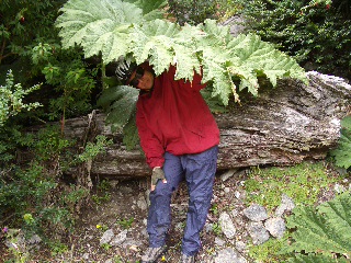
| Vegetation varies from a very sparse shrub on the slopes to a lush green wonderland down below. Hedgerows are colourful mixes of rosehip, calafate (blueberries), fuchsia, wild rhubarb, bamboo and fern. |
 | ||||||||||||||||||||||||||||
|
Who needs a brolly? | |||||||||||||||||||||||||||||
|
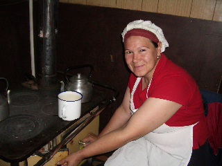
Accommodation varies from idyllic wild campsites with great fishing opportunities to log cabin style cabañas. In the few villages there are hospedajes or guest houses offering basic rooms for 10 euros per person with breakfast included. Failing that, there’s always the chance of a friendly farmer who’ll be happy to give you some shelter from the elements in his little wooden hut. | |||||||||||||||||||||||||||||
 |
 | ||||||||||||||||||||||||||||
|
Hospitable people and friendly faces on the Carretera | |||||||||||||||||||||||||||||
 |
 | ||||||||||||||||||||||||||||
|
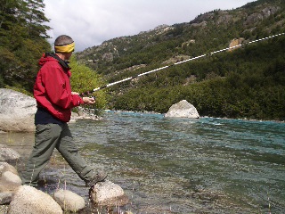
Kurt, the fisherman | |||||||||||||||||||||||||||||
|
|
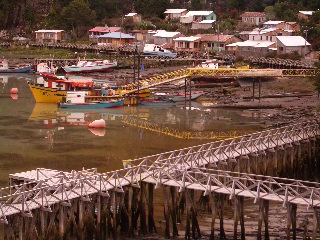
Built in a beautiful harbour, Tortel is a unique village on stilts with 7km of boardwalks, steps and bridges instead of streets. Cypress timber is the main business in this protected heritage spot… so don’t expect any seafood delights! | ||||||||||||||||||||||||||||
|
A keen, stray dog adopted us on the carretera, ran by our side for up to 60km a day and guarded our tent and bikes at night. His diet consisted of fresh road kill: hares and rabbits. He didn’t recognise meat when it had feathers on, and so turned up some grand juicy chicken schnitzel en route. We christened him Camino (meaning: way) because we found him on the way, he generally led the way… and often got in the way! |
| ||||||||||||||||||||||||||||

The marble cathedral |
One of the highlights on the carretera was the boat trip from Puerto Río Tranquilo to the marble cathedral. Erosion has hollowed out caverns and caves under marble cliffs and islands leaving thin pillars to support huge masses of rock. Sparkling in the sunshine with clear blue water lapping the smooth surfaces, this natural cathedral is both captive and mesmerising. | ||||||||||||||||||||||||||||
|
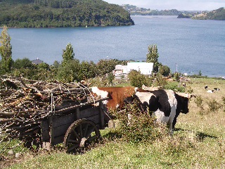
Every 10km we encountered a cow or two. Every 30km maybe a hut,and we were lucky to have a shop every three days. Not quite sufficient for retail therapy… but perhaps a couple of onions, cans, crackers and pickles. | |||||||||||||||||||||||||||||
 |
 | ||||||||||||||||||||||||||||
|
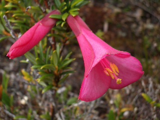
Chilean national flower: Coycopihue |
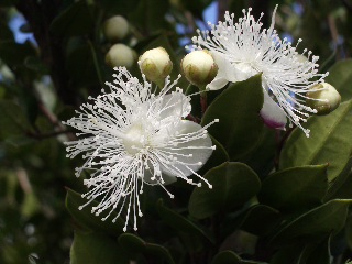
Wild flowers on the hedgerows | ||||||||||||||||||||||||||||
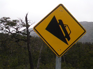
| Even though the Carretera Austral is like a huge national park with amazing picturesque scenes one after the other, it has to be said that it is a lot of hard work. | |||||||||||||||||||||||||||||
| The surface resembles a dry river bed of sand and stones. The only difference is that rivers usually find the easiest way to go from A to B, whereas the engineers here found the hardest inclines the most suitable route. In their defence it can be said that the bridges were level and often cemented… pity the rivers aren’t wider! To make up for this, we generally lapped each bridge 11 – 15 times to get the feel for a real road. |
| ||||||||||||||||||||||||||||
|
|
Pushing a heavy, packed bike uphill is no fun, especially when you can’t enjoy a speedy descent because of the loose, stony, corrugated surface. | ||||||||||||||||||||||||||||
| The landscape was its only saving grace, and when continuous rain robbed that from us we opted for a bus/boat connection to Chiloe Island. |
 | ||||||||||||||||||||||||||||
| After a long, wet day... | |||||||||||||||||||||||||||||
|
|
ChiloeIsland: This promised land of soft rolling hills, fertile green fields, colourful harbours and a moderate moist climate was like home for Darina. It’s from here that salmon begins its journey to the shelves of Migros supermarket in St. Gallen. | ||||||||||||||||||||||||||||
 |
 | ||||||||||||||||||||||||||||
|
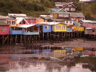
Palafitos of Castro |
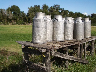
Milk ready for collection | ||||||||||||||||||||||||||||
| We indulged in delicious seafood and many traditional dishes including curanto: a casserole of chicken, mussels, chorizo, pork ribs, potatoes, dumplings and potato-breadall in a well-flavoured, full-bodied stock. |
| ||||||||||||||||||||||||||||
|
|
The 220km island hasa lot of industrious villages built around colourful wooden churches, which have been declared a UNESCO world heritage site. | ||||||||||||||||||||||||||||
|
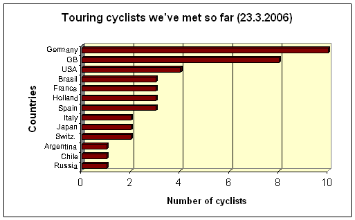
Although it’s almost the end of the season for Patagonia, we still meet the odd touring cyclist. Here is a graph sorting the cyclists we’ve met in South America according to their nationality: | |||||||||||||||||||||||||||||
|
| |||||||||||||||||||||||||||||
 |
 | ||||||||||||||||||||||||||||
|
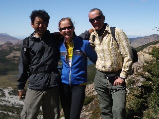
Tetsuyasan from Japan |
Andreas from Switzerland | ||||||||||||||||||||||||||||
|
Now that we have reached Puerto Montt, from a Chilean perspective, Patagonia is behind us. A popular saying is that he who eats calafate berries will return to the Patagonian region. Although we did blacken our mouths with these wild vitamins on many occasions, we also made doubly sure to take all the pictures we could ever need or want! |
| ||||||||||||||||||||||||||||